Rhodes Map
The island has been known as Ρόδος (Ródos) in Greek throughout its history. Ρόδος (Ródos) in ancient Greek was used to describe the pomegranate, whilst in modern Greek the same word is also used to describe roses.
It was also called Lindos (Ancient Greek: Λίνδος).[9][10] In addition, the island has been called Rodi in Italian, Rodos in Turkish, and רודי (Rodi) or רודיס (Rodes) in Ladino.
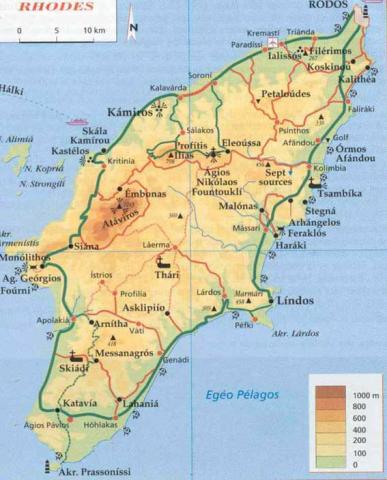
The island of Rhodes is shaped like a spearhead, 79.7 km (49.5 mi) long and 38 km (24 mi) wide, with a total area of approximately 1,400 km2 (541 sq mi) and a coastline of approximately 220 km (137 mi). Limestone is the main bedrock.[13]
The city of Rhodes is located at the northern tip of the island, as well as the site of the ancient and modern commercial harbours. The main airport is the Diagoras International Airport (IATA code: RHO), located 14 km (9 mi) to the southwest of the city in Paradisi.
The road network radiates from the city along the east and west coasts.